Fan Jiang
姜帆
School of Remote Sensing and Information Engineering,Wuhan University
Master of photogrammetry and remote sensing
Email: jiang_fan@whu.edu.cn
Tel: 15735182535
|
|
Fan Jiang姜帆School of Remote Sensing and Information Engineering,Wuhan University Master of photogrammetry and remote sensing Email: jiang_fan@whu.edu.cn Tel: 15735182535 |
中文版 |
I am currently studying in the GPCV (group of photogrammetry and computer vision) of School of Remote Sensing and Information Engineering, Wuhan University, My supervisor is Prof. Shunping Ji. I work in the field of visual slam / multi-sensor fusion / mobile mapping system.
|
mono visual SLAM tightly coupled with IMU and Wheels • Initialization conbined with Mono, IMU and wheels. • Tracking and Mapping using sliding window. |
| 2018.09-2021.06 | Wuhan University | photogrammetry and remote sensing | Postgraduate |
| 2014.09-2018.06 | Taiyuan University of Technology | Surveying and Mapping Engineering | Bachelor |
|
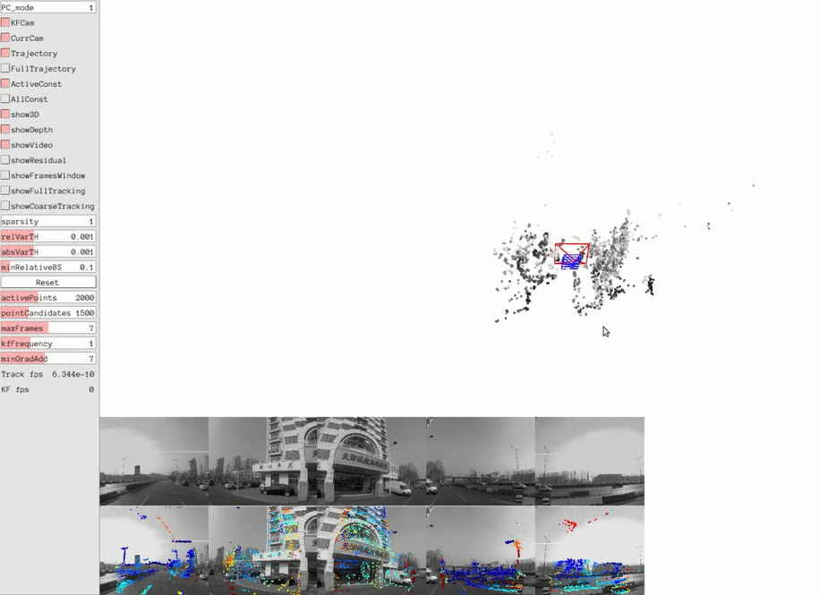
1.Panoramic SLAM from a multiple fisheye camera rig based on direcr method (In charge / under research) • The camera model of DSO is modified and the parameter setting of photometric affine transformation is adjusted • The photometric error function and Jacobian matrix of panoramic imaging are derived • Spherical epipolar search, spherical coordinate inverse depth update formula derivation |
|
|
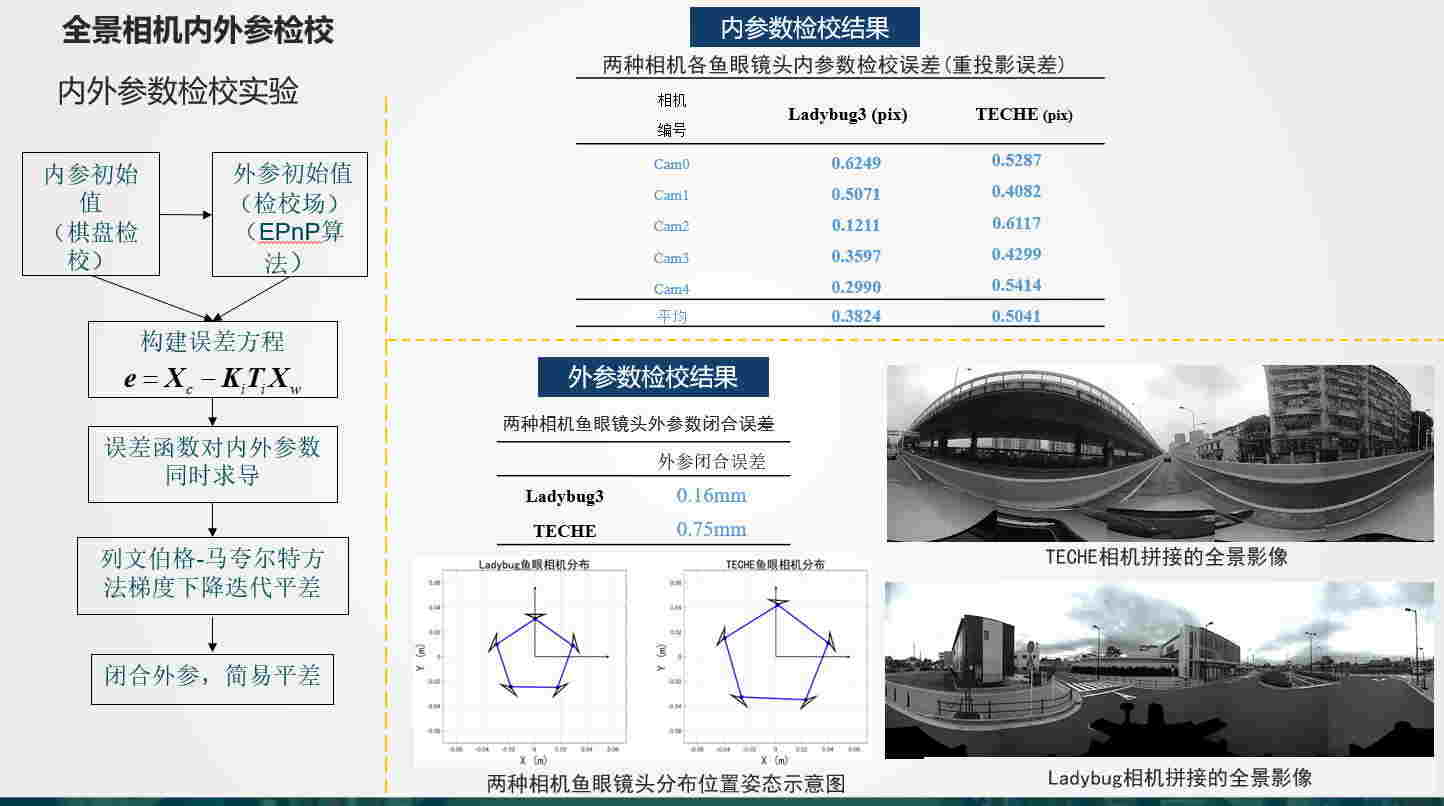
2.Calibration of internal and external parameters for multiple fisheye camera rig(In charge) • The general camera model and isometric projection model are used to calibrate the internal parameters of the single fish eye camera • Three dimensional calibration field is used to calibrate multi camera external parameters, and Ceres is used to optimize internal and external parameters |
|
|
3.Panoramic SLAM from a multiple fisheye camera rig based on indirecr method(participate in) • Responsible for the derivation of spherical EPNP formula and spherical Jacobian matrix • Responsible for g2o part of custom nodes and edges, back-end optimization part |
|
|
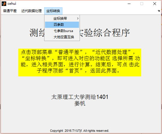
4.Matlab toolkit for geodetic coordinate transformation(In charge) • Complete the conversion tool including geodetic coordinate system, geographic coordinate system and projection coordinate system • Complete simple traverse adjustment and leveling network adjustment program • Complete settlement rank defect free network adjustment and gross error detection |
|
|
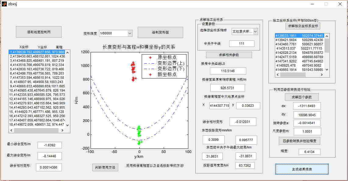
5.Design of geodetic city / mining area independent coordinate system • Accurately set the action area of design coordinate system • The design of independent coordinate system is better than 1/80000 to meet the requirements of comprehensive deformation measurement in * * coal mine • The design coordinate system adopts equiangular projection |
|
|
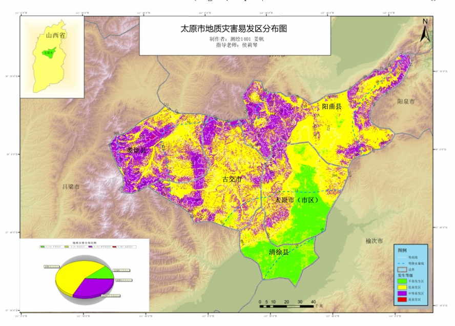
6.Analysis of geological hazards in Taiyuan City • The influence factors are rasterized and reclassified, and finally weighted superimposed • ArcGIS software is used to build the model, generate the analysis result map and make quantitative statistics |
|
| 2018 | Second class scholarship for graduate students of Wuhan University |
| 2016 | National Encouragement Scholarship |
| 2016/2017 | Academic scholarship of Taiyuan University of Technology |